Showing posts with label northwest. Show all posts

Saturday, March 1, 2014

A Fickle February is Done

February 2014 has gone down as a mixed bag of goods. The month started out very chilly with the 6th recording the coldest daytime high reading since January 4th, 2004. The month ended with a downright balmy 58.8 degrees and warm rays of golden sunny goodness beaming down from the heavens.

But March has a different idea for it has always been the fickle month. Arctic air has moved in overhead and that warm 58.8 from yesterday is planted in the past. Highs today and tomorrow will feel more like early January than early March. Snow flurries are in the mix for the next day or so as well. Since it is the first of March let's look at the February stats.

February looked like this:


The second arctic event of the season came in early in the month with cold temps and a significant snow event. I recorded my snowiest February in 13 winters of records at this location. I had 11.1 inches of mostly light, dry and fluffy snow. Enough snow fell in the first 9 days of the month to produce those giant plowed mounds in local parking lots that remained for the rest of the month. This event, like the one in December had more snow on the west side of the county than the east.

The coldest temp of the month was a 19.0 on the 6th and that same afternoon had the coldest daytime high of 22.2. The warmest day was the 28th with a balmy 58.8 under sunny skies and the warmest overnight low was during a blustery and wet event on the night of the 13th at 43.7 degrees. 

The short month of February delivered some much needed precipitation with a total of 6.76 inches of water equivalent precipitation. The snowiest day was the 6th with 5 inches and the wettest day was the 17th with 1.14 inches. 

The average overnight low was a little cooler than normal with 33.75 and the average daytime high was much cooler than normal at 44.19 when days usual average closer to 50 in February. Precipitation was about average for water content  just a touch low but snowfall was well above my 13 year average for February that is only 1.53 inches.

So the five year pattern of big snow events seems to be holding intact. January 2004, December 2008 (4 years 11 months later) and now February 2014 (5 years 2 months later). So all you snow haters can relax until the 2018-2019 winter season ;)

March is often a wild and unpredictable month that can see the first 80 degree mark of the season and also snow showers. So get ready for spring, it's closer than you think and by all means; soak it up my friends, soak it up.


Wednesday, September 11, 2013

The Last Ninety for Nine

How is that for a cryptic but quite likely accurate title for this late summer weather blog post? My station hit a toasty 89.4 degrees yesterday tickling ninety degrees but just failing to hit that "it's too darn hot" number. The official station at Pearson had 91 yesterday. Today however will be a different story. Ninety degrees will come quick and early in the afternoon and boil us all day long under a desert like blanket of big, bold, blue sky.

Either there is a Bunson burner under my temperature sensor or the NWS is right on the mark. The forecast today is for mid to upper nineties and if that pans out this will likely be the hottest day of 2013. Take that Autumn! Summer is stabbing at the fall, flailing away with all she has to give. It is that last blast of her furnace before the inevitable chill sets in next month. Today is expected to be the peak of this little heat wave and the last ninety of the year will probably fall on one of these next four days. The next time we'll see a ninety degree day most likely won't arrive until June of 2014. Nine months from now, thus "The Last Ninety for Nine" seems a fitting title :)

Our friends at the National Weather Service have this forecast along with a heat advisory for today.


Maybe this heat is just too much for you. Maybe you are secretly annoyed with Summer's attack on your long awaited season of brisk autumn breezes. Well the coast may offer you the solution. This NWS Cannon Beach forecast supports the conclusion that Coast equals Cool.


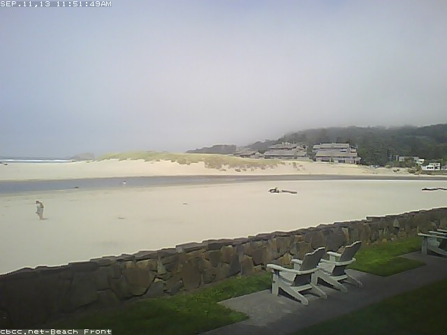
You can always play hooky and drive to the coast. Here is the situation at Cannon Beach, OR. It looks a little foggy right now (Noon) but will probably see a little clearing later on. Temps are almost always cool along the shore. This could be your last opportunity for somewhat warm weather along the Oregon Coast or SW Washington's Coast. As fall approaches the rain becomes relentless along those gorgeous cliffs. Autumn comes quickly.


Maybe the foggy coast is a little overkill on the beat the heat angle. 60's too chilly? OK Timberline Lodge could be the getaway for you! The NWS forecast for the historic Mt. Hood Lodge is 70s and sunshine.


Maybe a short drive up to Hood is just what the doctor ordered for heat expulsion. Keep in mind if you stay overnight it gets downright nippy after ten up at Timberline.


You know what do, get outside and take in the last blast of summer. If you don't fancy mid nineties then you will have to stay inside your cozy air-conditioned office until after 8pm. Of course, you could enjoy the coast or mountains one last time this summer. Either way, soak it up my friends, soak it up.


Sunday, September 1, 2013

August is in the Books

Another gorgeous Northwest month has come and gone. August was stellar, with near perfect weather the whole month long. It started off a touch on the cool side and offered up a little wet stuff towards the end. Even the wet days were quite pleasant however.

The stats were pretty standard for the month of August. I showed not one day above 90 degrees. The official station at Pearson logged two at exactly 90 degrees, however. The warmest day here in Northeast Vancouver was 88.3 degrees on the 6th the coolest afternoon high was the 63.3 on the 1st. The warmest evening was the 64.5 on the 29th and the coolest temp was recorded on the evening of the 21st with a low of 51.6 degrees. We had five days with precipitation exceeding 0.03 inches with the only real soaker being the 26th with a damp 0.49 inches. El sol blazed the big blue sky for 20 days. The total rainfall for the month was a less than average 0.89 inches.


It was yet another month of paradise in our 75 days of summer. Alas, it is now September. The Autumn plunge is lurking on the near horizon. Tomorrow is Labor Day and we could see some showers, although the NWS suggests that is only a slight chance. The remainder of the week should be unsettled with scattered thunderstorms.

We will likely have a few warm to hot days as the first part of September fades to the latter half and we start to feel that fall chill. The plunge begins now with the historical average temperature for the 1st of September at 80 degrees and the average for the 30th is just a touch above 70. The 10 degree plunge is followed in October by a 14 degree drop, then November with her 11 degrees till we bottom out around the end of the year. It happens fast so get out and enjoy these last few 80s and maybe a bonus 90 before the plunge puts a chill on your outdoor activities. You know what to do. Soak it up my friends, soak it up :)

Thursday, July 25, 2013

Great summer weather continues on and on and on...

Our run of great weather continues. As is typical for the "dog days" of summer it doesn't look like the good news is going away either. More 70s and 80s are on tap for the next several days. We may get a hiccup in the pattern or stray thunderstorm here and there but we should be all clear for quite some time as the 75 days of our glorious summer stretch on towards the horizon.

Here is the NWS forecast:

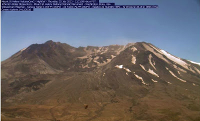
Take a look at the USGS "Volcano Cam" up at Mount St. Helens. This is a live camera that runs year round.  It is showing nearly 80 degrees up at Johnston Ridge.  That is worth the drive to see the mighty volcano that violently erupted 32 years ago. The devastation remains today.