Thursday, December 1, 2022

Chilly and Wet November in the Books

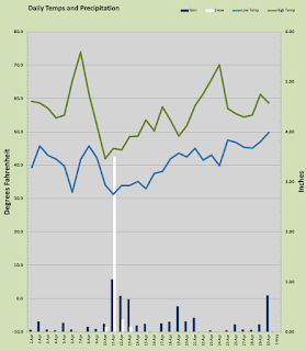
After last month's record heat one might expect a warmer than average followup yet this past month was much cooler than my 21 year rolling average and it was nearly as cold as October was hot relative to "normal." November delivered near normal precipitation and temps that were on average 3.5º cooler overnight and about 3.5º cooler by day as well than my 21 year normal. Five daily records were broken all cold records four overnight lows and one daily cold high. The all time monthly record for cold either overnight or daytime was not challenged, not even close in fact.

The warmest day last month was 57.2º on the 5th with very heavy rain coming down. The warmest overnight low of 47º came on the 4th with a wet system on approach. The coldest overnight low arrived the morning of the 19th when my thermometer reported 19.8º under clear skies. The coldest daytime high was 37.8º on the 29th under mixed precipitation. That was not a daily record cold high. Records broken for the month were all local daily records from my 21 years here. They were morning lows of 31º, 24.5º, 21º, and 19.8º on the 13th, 14th, 17th, and 19th of the month. None of these cold temps was close to challenging my all time November low of 13.8º back in 2010. The daily record cold high was not that chilly but it came early in the month on the 7th with a 42.9º mark. Overall November delivered seven days with subfreezing temps, one day under 20º, and five others in the 20s. Every day but one managed to get above 40º in the afternoon, and eight days made it to the 50s. 

Precipitation ran close to normal with my number shy by less than an inch of my 21 year normal. 7.06 inches fell almost all of it as rain but a little wintry mix as well. There was no sticking snow at my house. Sticking snow was found as low as 500 feet above sea level. The wettest day came on the 5th with an all day deluge of 2.06 inches. That was one of two days exceeding an inch and seven days that exceeded 0.25 inch. All told 14 days with precipitation against nine sunny days. Nine sunny days in November is actually pretty damn good :)

It seems like we are headed towards another cooler than average month but one never knows what the weather will decide to do. I would expect some sticking snow down to sea level at some point in the next few weeks.


Thursday, November 3, 2022

Warmest October I have yet Recorded

You read that right friends. This October was a scorcher, well for October at least. I set more warm daily records than ever before in any month and this is my 21st October keeping temperature records at this location. 13 daily high records fell for this location and two warm morning low records as well. That is nuts. It gets nuttier because I also recorded my warmest temperature ever for October. Generally in October we get a couple of warm days in the upper seventies of maybe an 80º temp almost always in the first 10 days of the month. Then the rain train arrives and that's the end of that. Not this year, we had a proper Indian Summer with three weeks of warm weather mostly in the 70's and 80's. The end of the month was more like a regular October with rain and cool temps.

So what's all this fuss about? Here it is: October, 2022 featured the aforementioned 13 daily record highs, 2 warm low daily records, and the warmest October temperature on record at this location. All of this scattered among just 9 sunny days, 8 rainy days, and the rest were cloudy or foggy or partly cloudy. There were ten days in the 80s, and 12 in the 70s. The month was so warm we didn't get anywhere near freezing all month long with the coldest temp coming on the 12th at 38.7º and I had nary a frost. The the warmest temp of the month, my all time high for October was on the 2nd with 86.1º under brilliant sunshine nudging past the previous all time October high of 83.8º and 6º higher than the previous record for the day. The other daily records were as follows, 84.0º on the 1st which was an all-time October high for me for one day until broken on the 2nd, 81.0º on the third, 81.3º, 83.8º, 82.1º, and 75º on consecutive days the 7th through 10th, followed by 5 consecutive daily highs on the 12th through 16th with marks of 78.6º, 83.2º, 80.1º, 85.6º (8.8º above the previous daily record), and 81.2º. But we were not done yet breaking daily records, on the 20th a mark of 69.6º was enough to take the record. All in all this past October had four daily highs that were enough to tie or break the pre-2022 all time monthly record! We even added two daily records for warmest overnight low done on consecutive nights on the 5th and 6th with marks of 57.4º and 56.3º respectively the latter was the warmest morning low for the month and the only morning under 40º with a reading of 38.7º on the 12th. 

God didn't;t turn on the water spigot till the last week of the month and we got all of the month's rain in a 9 day period from the 22nd to the 31st with a sum total of 3.78 inches which is almost a normal October month of rain. All in the last 9 days. 1.1 inches on Halloween capped it off. 5 days over a 1/4 inch and 3 days over a 1/2 inch or rain. 

The temperature average for the month was L 49.73º and H 69.83º more than +4º overnight and nearly +8º by day. Crazy.

This week has a very seasonable forecast with snow levels dropping down to the lower foothills later in the week then rebounding back above pass levels but not a single warm day in the outlook. We will likely get out first frost of the year this week and highs will remain in the 40s most of the week. Now that's November :) 

Soak it up my friends, soak it up.


Sunday, October 2, 2022

Hello Autumn

September is in the books and with the new month we are fully embedded into the Autumn season. Trees are starting to show some color and overnight lows are dipping into the upper 40s. Although Indian summer isn't really a thing here, we can and do get a few warm spells in early fall including today in which the high is expected to get north of 85º. 

Last month was very dry for September and the temps were well above my 20 year average for the month. September refused to let go of summer and in that fit managed to break several daily high records and so overnight warm records as well. October may fight for a few days but ultimately should succumb to the forces of nature.

A total of seven daily records fell all warm records, four overnight low records were set for daily warmest low temp and 3 daily highs were set. All four overnight record warm lows were in a row from the 10th through the 13th at 66.3, 62.4, 61.8, and 63.7 degrees. The daily record highs came on the 19th with 82.9º, the 25th and 26th with 87.5º and 88.3º respectively. The warmest temps came on the 6th with a register of 91.5º well short of the 96.4º record. That was also the only 90º plus temp for the month. Only one overnight low dipped into the 40s with the coolest mark on the 23rd at 48.2º. Every single day last month managed to get above 60º and the chilliest afternoon was a nice 68.4º on the 16th. September was kind enough to deliver 14 sunny days and just four days of precipitation.

Precipitation was sparse with the 29th being the only day above 1/4 inch in the bucket, and barely at that with a mark of 0.27 inch. Total precipitation came in at a measly 0.49 inch just 1/5th of average for September. 

Let's hope October brings enough rain to offset September's belligerence. I need two more FEET of rain by the end of the year to make it to normal levels.


Thursday, September 1, 2022

Another Month of Sizzle

August is in the books and it was toasty. No seriously, really toasty. Even though the month did not produce any triple digit temps it did produce some record heat with 11 daily records scattered among both highs and lows. It also produced a month average daily High, Low, and mean temps well above average.

August had 8 days with temperatures above 90º and 25 days with lows above 60º. There were 22 sunny days and just 2 cloudy days. August also failed to produce any measurable rainfall. I did have one day with noticeable drizzle, but it evaporated before hitting the ground or on immediate impact and did not trigger the rain gauge. It was enough to get my arms damp, but that's about it.

The coldest over night low was 57.1º on the morning of the 28th and the coolest afternoon high was a mark of 74.3º on the 27th. Ok so those "cold" temps are not very cold at all, what about the heat? Well the warmest temp recorded last month was a toasty 97.8º on the 30th and that was a daily high record. Some areas around the Metro area did top 100º on the 30th and on the 7th but triple digits stayed away from my station. There were a total of 3 days above 95º among those 8 above 90º.  Only 6 days in August failed to reach 80º and 19 days topped out above 85º. Keep in mind that the average August high temperature in my 21 years of recording is just 81.09º and 70s are common highs in August. Not this year! The warmest overnight low was a toasty 72.9º on the 18th. 

The month's average low was 62.42º and the average daily high was 85.51º. Overnight lows were really the story for August 2022. There was just a single day all month long that was cooler than average for the overnight low. In fact the average overnight low was a full FIVE DEGREES above my 21 year "normal." Daily highs were 4.5º above my average. August had a mean temperature a bit warmer than July. Overall the summer has been Kathy toasty despite having a modest number of "heat waves." 

Not much to talk about on the precipitation, there was none. Typically August does get something usually an inch or so, but it is not at all uncommon to have a completely dry August or July for that matter. 

September started off with a heavy marine layer that likely settled in on the evening of the 31st at the coast and spent the whole night and part of the morning pushing inland along the Columbia River. After a 110 miles it finally arrived in the metro area around 7 or 8 this morning. That's the first time in quite awhile I have seen any marine action this far inland. Perhaps the onshore flow will cool us down a little this month.

These next few weeks will mark the end of summer and as the month progresses it is quite likely we will notice a bit of chilliness in the evenings replacing our typical summer warm evenings. Autumn is lurking in the near distance, and I welcome her.  


Monday, August 1, 2022

Sizzling July Sets Nine Daily Records!

After that cool wet spring summer decided to come with a vengeance and a flame thrower. Now in all truth, the high temps were not the real story. Sure I had a day over 100º and a whole bunch of upper 90s but the overnight lows were the real story. Seven daily records fell for warm overnight lows. Two daily high records fell. 

The warmest day was a 100.1º mark on the 26th which was part of a string of consecutive days above 90º and keep in mind that I average about a dozen 90 plus days a year! To get eight in a row is very unusual. The coldest temp was a comfortable 55.6º the morning the 18th. The coolest daytime high arrived on the 2nd when the mercury barely topped 70 with a 70.3º reading. The warmest overnight low was a warm 70.2º on the 30th. July delivered 18 sunny days with one day over the century mark and 11 days over 90º. The average daily high last month was a whopping 4º over normal and the overnight lows were about 2º over. The real interesting part of this was the humidity which was a bit higher than normal for warm weather. Typically 90º days are met with warm dry interior air that keeps things bone dry but this 8 day streak had humidity levels in the 30-40% range which is the sticky south, but it did lead to heat indexes a few degrees above the actual temps.

As for rainfall July did not disappoint as there was just three days with rain and not much at all totaling a mere 0.26 inch for the month well under the July average of 1.02 inch.

August begins warm and a bit cloudy so we shall see if August plays the same tune.

Friday, July 1, 2022

Drippy June leads to Sunny Summer

June was a bit on the wet side with cooler temperatures overall than typical. There was one heat wave with temps that should have been record breaking but they landed on the exact same weekend as last years HYPER-HEAT event and those records will last a lifetime. Despite the wetter than average June the month followed the classic "Rose Festival low format with cool, cloudy, and drippy skies for the first three  weeks followed by summer-like weather to close the month. You can set your watch to that late spring low pressure trough, every year it seems and this year was no different. 

Temperatures were mostly mild averaging 55.7º low and 72.9º highs the latter was spot on "normal" and the overnight lows were about 3º above normal likely due to extra cloud cover. The warmest temp I recorded was a toasty 98.1º on the 26th well below the crazy 107.1º recorded a year earlier. That was one of three days with temps above 90º all three in a row that same weekend. A warm overnight low of 68.4º was recorded that night the warmest of the month but falling short of the record, again posted last year. That was one of three nights where the temps remained above 60º. The coolest measurement came on the 7th with a 48.9º mark one of just two days that dipped below 50º. The chilliest daytime high was a brisk 58.1º recorded on the afternoon of the 13th. It was one of three days in June that failed to reach 60º. It was also the coldest daytime high I have ever recorded on that date, the June record is 53º. 

June produced three days above 90º, 7 days above 80º, and 16 days above 70º. Typical I suppose for June. 

On the precipitation side of the weather June was wet with a solid 3.69 inches of rain versus my local normal of 2.47 inches. This soggy spring has made up for the dry-ish winter as my local totals are now at normal with 27.8 inches in the bucket measure against a typical 1st half total of 28.5. The wettest days was the 11th when a gusher of 1.49 inch fell which was one of four days over 0.25 inch. We had 11 rainy days against 9 sunny days and the rain spigot shut off on June 20 allowing for 10 straight dry days. 

Late spring wet weather often leads to flooding as mountain snowmelt in late spring can swell rivers and streams without the help of any rain. Add a foot of spring rain and things get dicey. This year the mighty Columbia crested its banks for the first time in years hitting flood stage in the middle of the month. Little to no damage but none-the-less watching the largest river in the Eastern Pacific crest its banks is a bit unnerving.

July started off with some morning clouds opening up to yet another sunshiny day! Soak it up my friends, soak it up!


Wednesday, June 1, 2022

Soggy Flowers this May

Wow May was more like April and last April was more like March. We seem to be a month behind this year. Overall the Month was pretty typical overnight but quite a bit chilly by day relative to my historical average. And... yes... there was this... 4.95 inches of rain which is WAY above the typical 3.25 inches at my location. 

Temps were mostly chilly averaging 4 degrees under normal by day and just a smidge above by night. I had just four days above 70º including the warmest day of the month on May 31st at 75.3º. Every single afternoon managed to poke up above 50º but on the 8th just barely with the chilliest afternoon high of 50.8º which was a daily record cold high temp. 11 days failed to reach 60º last month. 

Overnight lows were a tad above average likely due to all the cloud cover. The coldest low temp came on the 9th with a 39.7º mark one of two sub 40º mornings. 30's in May are unusual but neither of last months managed to break a daily record. The warmest overnight low came on the 15th and that was a daily record at 57.4º. 

Precipitation was the real story last month. For the second straight month we were way above average for rainfall. May came roaring in with the aforementioned 4.95 inches in the bucket. 18 days with measurable precipitation against just 2 sunny days and I am being generous there ;) Five days delivered more than a 1/4 inch of rain and the wettest day was the 7th when nearly an inch fell at 0.98 inch. With the exception of yesterday and the 21st every single day was either rainy or threatening rain.

June is starting off a bit similar but a tad warmer. The first half of June is notoriously cloudy and damp round these parts but we will see if April and May squeezed out most of June's precipitation. You never know.

Soak it up my friends, soak it up.

Sunday, May 1, 2022

April was an Angry Month

April was all about precipitation this year. It was wild, wet, and chilly all month long. We had quite a ride and the month of May is starting off more of the same. Although there were some notable 20 year records, there were no all time records broken this past month.

Let's dive into the temps. April was the coldest and wettest on record at my location dating back 20 years. That said I did not set a single overnight low record. The average daily low and high were 1º under and 4º under normal respectively. 

The warmest day was April 7th when a big bright sun got us up to 73.8º well short of any records. That was one of only two days to push through the seventy barrier. In fact only seven days managed to get to 60º. Six days failed to reach 50º but every day made it over 40º. The warmest overnight low arrived on the 30th with 49.7º.

The coldest low was also no where near a record, but was one of two days that dipped below freezing, the chilliest on April 11th at 31.2º. Not a single day last month stayed above 50º overnight and 18 days dipped into the 30s. The coldest afternoon high arrived on April 11th at 41.9º.  It came along with nearly 4 inches of snow. That chilly afternoon high turns out to be the coldest April high temp since I began my records 20 years ago. This was one of six days that failed to get above 50º which is not super unusual in fickle April. 

Precipitation is where the interesting stuff happened. April tends to be showery round these parts but this last April looked more like January other than the warmer temps of course. There were just three sunny days and I may be a little generous at that. 23 days with measurable precipitation which totaled 6.14 inches. That is January levels of rain my friends and well above my 'normal' of 4.24 inches. This was the rainiest and snowiest April on record for me. The wettest day came April 11th... surprise that date comes up again ;) 1.05 inches of water but much of it fell as wet sticking snow. That was one of six days over a 1/4 inch of rain. 

So the elephant in the room is that snow event that started innocently as mixed precipitation with just a wee bit sticking on evening of April 10th. The morning of the 11th saw that mixed precipitation change over to all snow around mid morning. Most of the greater Vancouver area got at least an inch of wet snow, my location tends to yield more snow than Downtown and Pearson Field where 'official' measurements are taken. I'm pretty sure its is my proximity to the Cascade Foothills. Anyhow I had 3.5" piled up on the ground by late morning; enough to wipe out my gazebo. I had just installed the canopy for spring... oops. 

That is by far the largest snowfall I have recorded at this location in the month of April. It is however, not the latest I have ever seen sticking snow. April 19th, 2008 I got an inch. I did receive snow flurries in May once, but that never stuck, in fact I recall the flakes were melting before they even hit the ground.  

This snow took almost a week to melt off. I saw parking lot snow mounds last weekend still lingering at Home Depot in East Vancouver.

So this past April was truly a wild weather month. Hopefully May will bring us the warmer spring weather that April couldn't muster.   

Soak it up my friends, soak it up.


Friday, April 1, 2022

March was in like a cool, wet lamb and out the same.

Temps were a bit above average but we didn't have any real warm days either. March tends to have a couple of warm 70+ days along with some chilly weather but this time it was fairly flat... for March. Rainfall came in pretty close to normal and no snow fell. 

The warmest day at my location was March 27th when I read 68.5º although other areas around the metro popped up over 70º. I did have one record high on the 22nd with a 66º mark that was second best for the month but the warmest I have ever had on that date. The warmest overnight low was a balmy 47.1º on the 2nd of the month following the wettest day of the month. The coldest temp I recorded last month was a nippy 28.6º on the 10th but not quite into record territory. The coolest daytime high was 47.5º on the 8th, no where near any records there. March delivered seven days above 60º and two nights that dipped below freezing. Five days failed to reach 50º and 17 days stayed above 40º all through the night.

The precipitation was pretty steady with 5.12 inches in the bucket just a touch off the average for March. Six days saw greater than 0.25 inch and the Noah event came on the 1st with 1.85 inches under warm 'Pineapple Express' conditions. 17 days saw rain and just one day was sunny and I may be cheating just a tad... it was probably more like partly sunny ;)

Since the snow season is officially over I'll go into snowfall data for the season. April can have sticking snow but it is usually just flurries if anything this late. I had below average snowfall for my location this season. I measured 7.1 inches. None in November, 6.6 inches in December, none in January, a light dusting of 0.5 inch in February, and none in March. The max depth was just 3 inches on the 28th of December. I had 10 days with measurable snowfall and 14 days with at least a trace on the ground. Nothing to see here folks ;)

April is here and the real spring may appear any moment, that is no fooling. Soak it up my friends, soak it up.

Friday, March 4, 2022

February a mixed bag of chilly and warm

What a month. February turned out to be a heatwave wrapped in cold burrito! I managed to post two daily record highs in a row, a daily record low max temp, four daily morning low records in a row as well! All in the same month and the shortest month of the year to boot. After all the turmoil and the rollercoaster temps, the month came in almost dead average on both ends of the day!

This time I'll start with precipitation as the month came in bone dry looking more like Eastern Washington than Western Washington with just 1.86 inches of rain in a month that tends to produce closer to six inches. I did record 10 days with measurable precipitation but mostly drizzle aside from the 2 days with more than a 1/4 inch. The wettest day was the 28th with 0.64 inch that led the lion of March in, but that's a story for next month. 

February managed to produce snow on the 24th, but a very meager 0.5 inch at my house. It turned out that this minor snow event was highly localized as some areas saw more than an inch of fluffy snow. Some arctic air hung over the area for nearly a week and the tiny dusting of snow stayed on the ground in the shady areas for a few days.

Temps were the real wild animal of February. Despite the overall month coming in at an almost exact statical normal, Pat Timm's expression of "normal is just a collection of extremes" was ever present last month. The warmest temp of the month was a daily record high of 64.2º on the 11th which was literally 1/2 degree off my local all time high for any February in the last 21 years. The lover's month produced another daily record high on the 12th at 61.5º for two 60+ highs last month. But February was just getting started and these two warm days were the top of the roller coaster. Some modified arctic air decided to float over the top of us later in the month and it managed to deliver a few daily records for chilly weather. From the 22nd to the 25th four straight local daily record lows happened. The coldest being a 14.8º mark that I though might be my 21 year record low for February but it was short by 0.1 degree. February is not noted for frigid over night lows but that arctic mass had other ideas. That was one of two mornings with temps below 20º last month. I even had one daily record low max temp when the mercury topped out at 36.4º on the 22nd. That day was a day of strange timing. A weather system moved through the area in the afternoon dumping a chilly 0.19 inch of rain. Had that disturbance come in a little earlier over the top of the 23º morning low, that could have been a 4 inch snow event. 

There were only five days recording temps below freezing and the aforementioned two mornings with sub 20º marks. Also the two warms days above 60º. Six days last month managed to stay above 40º all day and night. There we only three days that failed to reach 40º at all but everyday managed to get above freezing. We had 10 rain days and 4 sunny days.  

The very tail end of February saw some heavier rain and that lead into the first few days of March with drenching rains to start us off. We'll have to cover that next month.


Tuesday, February 1, 2022

A Very Typical Start to the New Year.

Last month went down like a statistical norm. Temps averaged out to less than 1º under average by night and less than 1º over by day. Rainfall was an inch shy of my 20 year average, but still pretty 'normal' by my book. The month was not without it variances as I did manage to post two 20 year daily lows as well as three 20 year daily highs all with in the confines of a normal January.

The year started off right out of the gate with the chilliest morning of the month on New Year's Day posting a 19.4º low which to my surprise was the coldest January 1st at this station in 20 years, and the only temperature of the month below 20 degrees. This is one of two daily record lows at my house to fall the other a 20.9º mark on the 26th. That one less surprising as the latter part of January tends to see average temps rise quite a bit from the dark and chilly weeks around the Solstice. These two records were among the 10 days with sub freezing temps, a pretty typical number for January. 

The other three daily records were warm afternoon highs with the first on the 6th with a 55º day, then the warmest mark of the month at 58º on the 12th, followed up later in the month with a 56.7º degree reading on the 20th. The warmest overnight low came on the 13th with a mark of 44º one of six warm evenings in the 40s. The chilliest afternoon high arrived on the very first day of the year following that daily record low when the merc stopped at 36.8º well above the daily record and one of three days that were trapped below 40º. A total of four days managed to breach the 50º mark also not that uncommon. 

The rain gauge collected 6.04 inches of precipitation all in the form of rain. January on average is the 'snowiest' month but this year saw nary a flake. I've average 7.05 over the years so a tad under but still typical for the month. The wettest day arrived on the 6th with 1.48 inches which was the only day with over an inch and one of seven days over a 1/4 inch. January delivered 14 rainy days and 2 sunny days. Several of our would be 'clear days' came under a heavy inversion layer in which fog was stuck at the valley floors while the foothills and mountains were sunny and quite warm in the 50s. The foothills above a thousand feet had at least a dozen sunny days.

Will there be anymore snow this year? Well that's a tough one as 85% of our average snowfall comes in the three months associated with winter, December, January, and February. We were well above average in December this year, I posted 6.5 inches, but January was a zero. Odds are, some snow will come this month but even if we go a snow free second half of the winter season, we will still be at 75% of normal snow so I'll say we have a 65% chance of at least a dusting of snow before the season ends. 

Soak it up my friends, soak it up.


Saturday, January 1, 2022

Happy New Year!


2021 went out cold and snowy but 2022 may start a little warmer and rather wet. So this is the end of year blog where I not only wrap up last months stats but glance back at the whole of 2021 weather wise.

December 2021 was wet and frankly other than about double the normal snowfall it was pretty normal over all. Temps followed the typical dive through the month and were mostly average. The warmest day was the first day of the month with a balmy 59.8º. Some areas in the metro area were up above 60º and some daily record highs fell including mine. The chilliest temp came on the night of the 27th under cloudy skies and scattered snow showers with a crisp 23.1º a local daily record for me. That afternoon also recorded the coolest daytime high for the month at 29.5º That was also the coolest daytime high I have recorded any prior December 27th. The warmest overnight low was a 45.6º mark on the the first of the month that surely helped push that daytime temp to a daily record. Overall the observed averages for the month were L 35.61º and H 44.13º about 1º warmer than normal at both ends of the day. December yielded just 7 days with subfreezing temps. There were also just 7 days that failed to reach 40º as well. Despite the 9 days with measurable snowfall every day but one managed to get above freezing in the afternoon. 

Precipitation was a bit above average with 8.85 inches in the bucket including 6.6 inches of snow. 27 days in December had measurable precipitation including 9 days with snow. There were 10 days with more than a quarter inch of rain. The wettest day was the 19th with 1.8 inches in the bucket. Later that day it changed over to snow and dropped an inch of wet snow. 

So wrapping up 2021, we had a mild year really. Just 26 days that fell below freezing. Those are Northern California numbers! Not a single day dropped below 20º either. We had 52 days with overnight lows above 60º and 86 days with highs that failed to reach 40º. Only 2 days failed to get above the freezing mark. Mild indeed. 

The real story of 2021 was the all time record heatwave in which we broke the all time record high temperature three consecutive days and by large margins! This happened in JUNE of all months. On June 26th the all time record at my house of 106.5º fell with a 107.1º then the 27th it was 111.1º and then on the 28th the monster 115.2º mark hit. The weird part was that a town in Canada hit 117º and now has a higher all-time record than Las Vegas NV! That was some kind of strange atmospheric and heat lineup that only occurs every 500 years or so. 

We ended up with 5 days over 100º in 2021 and that ended a three year drought on 100 plus temps. We had an above average number of 90º degree marks at 19 for the year. The hottest day that scorcher 115.2º on June 28th the coldest was 23.1º just a few days ago on the 27th of December. We had a total of 19.35 inches of snow for the year, most of it falling in two events in February and last week. I had 42.72 inches of rain well below my typical 53 inches. 2021 delivered 95 sunny days, 146 rainy days including 14 days with snow and 43 days with more than 0.25 inch. One note to show how mild our 2021 was, Only 86 days had high temperatures below 50º so that says a lot about how mild the cooler half of the year was. The summer was even pretty mild if you take out that crazy heatwave in June.