Showing posts with label hot. Show all posts

Tuesday, May 1, 2018

April Showers and a heatwave!

April is in the books and not surprising, she was rather fickle and feisty. The month started out with a some chilly weather including lows below freezing and highs int eh middle 40s. That's chilly in April. But it didn't take long for Mr. Hyde to switch back to Dr. Jekyll and some nice spring weather presided over several days early in the month. Up and down and back and forth Miss Spring toyed with us in April. The showers we expect in April were a bit under the typical. Towards the end of the month Mr. Hyde emerged again and this time he was a bit 'hot' under the collar with the first 70° mark coming in at nearly eighty degrees and temperatures that would get into the middle to upper eighties.

On the thermometer we saw a seesaw of action. The coldest mark cam on the morning of April 3rd with a sub freezing 30.4° one of 11 days with lows in the 30s which is a bit many for this late in the year. The chilliest afternoon high was the day of the fool, April 1st when the mercury topped out at a nippy 46.8°. On the other end of the spectrum the warmest temperature was a toasty and very July-like 86.4° on the 26th. That hot day followed the first eighty plus mark of the year on the 25th when it was 82.9 and that followed the aforementioned first 70 when it was 79.7° on the 24th. The weird part was that the day after the scorcher only managed a high of 55.9°. What a quick departure from summer and back to "early" spring conditions. Average temps over the month were a tad above my 17 year average with 43.7° low and 60.84° high, 2 and 1 degree over respectively.

Nearly all of the month's rain came in the first half and only 2.8 inches hit the pan well shy of my typical 4.24 inches. Nary a flake of snow fell in the valley but there was quite a bit of low elevation snowfall for April with the local foothills getting several dustings over the month. The higher foothills such as Silver Star still have bits of winter clinging to the surface here in May. The wettest day was the 7th when I recorded 0.61 inches.

So far May is starting out rather cool and uneventful. The weather gang at NWS Portland seem to think some nice spring weather with highs in the low to mid 70s are coming up later this week. Springalicious!

Soak it up my friends, soak it up.

Tuesday, September 1, 2015

August is done, is that Autumn I see peeking over the fence?

Many people enjoy a good long summer. And a good long one we have had. Generally this part of the country sees 75 days of summer starting around the first of July and ending in early September. But this year our warm and dry weather began all the way back in May! It was well above average in terms of temperatures and well below in terms of rain. Nirvana for some and for others it's "Hey Autumn come on over, Summer has worn out its welcome".

August was a bit warmer than average but not as warm as July. Temps ran just a couple of degrees on the upside both overnight and by day. Average daily high for the month was 82.22 and the average low came in at 57.73 degrees, 2.2 and 1.3 degrees above normal, respectively.

The heat monster maxed out at 96.4 degrees on the first day of the month, following a short triple digit episode at the end of July. This was one of three days last month that breached the 90 degree barrier. That is about normal for August. The coldest temperature recorded was a nippy for summer, 49.2 on the 22nd one of two evenings to drop into the 40s. The coolest afternoon high came on the 30th under blustery and wet conditions and was the only day that failed to reach 70 degrees with measly 67.2 measured. The balmiest night was a comfortable 65.1 on the 12th.

The drier than average trend has continued with August posting 0.81 inches compared to my typical 1.27 inches. July and August are often very dry so it is of no consequence like it was in May and June to have these conditions. The wettest day came on the 29th when 0.31 inches fell.

Overall the month of august was actually pretty typical if not just a tad on the warm side. One can only hope that the fall will bring with it some much needed rain and may the winter bring a healthy snow pack to our abnormally barren peaks.

Get out and soak up the last of summer my friends, soak it up!    

Wednesday, August 19, 2015

The Heat is On... Again

Well over 90 degrees today and probably again tomorrow. We have had at least 20 days over 90 and even some triple digits so this summer will go down as a warm one. Fear not,  ye who prefer our cooler days, more seasonable temps are coming soon. oh go ahead and soak it up already, soak it up my friends.

Wednesday, July 1, 2015

June was... Well... July-ish

The month of June is in the books and there is no other way to say it... It was VERY WARM. Although I never saw the realization of triple-digit heat like the NWS was suggesting, It was warm in general across the whole of the month.

Just so we are clear, prior to entering the data for June 2015, my 13 year average high for the month was 70.68 degrees. After entering this year's data that number jumped to a 14 year average of 71.52. That is nearly a full degree just from one month's data. The average daily high for June, 2015 was an warm 80.48 degrees and that is TEN degrees warmer than the previous 13 year average for the month.

June is a spring-summer transitional month weather wise. Generally we have a mix of cooler spring weather and some warm summer weather. This June was bone dry and very warm. How about 26 sunny days! That is about three June's worth of sunshine my friends.

As wonderfully warm June was, it was woefully dry in a year that has already been arid over all. My location is 10 inches drier than average through the first 6 months with a paltry 15.91 inches of precipitation. The NWS is suggesting July may end up without any precipitation. We could sure use some wet stuff.

Here is how everything played out. 26 sunny days and just 3 with rainfall. the month of June had 17 days with 80 or more degrees on the mercury. The aforementioned average high of 80.48 was nearly ten degrees over the normal with an average low that was just over 55 degrees; that's about 3 over my established norm. The hottest day came on the 26th with a mark of 94.6 degrees, The balmiest overnight low followed the hottest high with a mark of 68.1 on the morning of the 27th. The coldest daytime high came early in the month during some squalls. The 2nd was the only day in June that failed to reach the 60s with an "almost there", 59.3 degrees. The coolest overnight low was a chilly 45.6 on the 13th.

We had 3 days at 90 plus and 5 with overnight lows in the 60s. We also had some contrast with 4 nights in the chilly 40s.

Here is the real shocker. My location only recorded a measly 0.53 inches of rain. That is July dry and well under my normal of 2.47 inches. Get ready my friends for a warm summer filled with sunshine and smiley faces. Then prepare for the typical angry winter that follows such frolicky summers. Ah, go ahead in soak it up my friends; soak it up!

Saturday, September 20, 2014

90s as Summer's Final Few Days Wind Down

I hit 90 plus today and the autumnal equinox is less than three days away. This is probably the last heat wave of 2014 so I suggest you get out and soak it up my friends, soak it up.

Saturday, September 6, 2014

The heat is on!

Those East winds are blowing and bringing with them high temperatures. I very well may see the hottest day of the year today. It is 95 degrees already and it's only 12:30. I have yet to record triple digit heat this year but today could be the day. Hold on to your hats or the East wind will blow it off. Today is going to sizzle like bacon on a griddle. Ouch! Be careful out there; this is the kind of weather that can overwhelm you. Drink lots of fluids and stay out of the direct sunlight. Cover up and of course don't forget to soak it up my friends, soak it up :)

Monday, September 1, 2014

August is in the Books

August was indeed a warm month here in America's Vancouver. Both the overnight lows and daytime highs were well above the normal with observed averages of 58.6 and 82.41 respectively; each nearly three degrees above. This past august also brought with it the hottest day of the year thus far with a blistering 98.4 on the 11th. The chilliest afternoon was the 30th which was also the only day of the month that failed to reach 70 degrees topping out at just 68.7. There was only once instance where the mercury plunged below 50 degrees and that was the night of the 21st with a cool 49.2. The warmest overnight low was a balmy 66.9 on the 12th; a day that would deliver some thunder and lighting. This month produced 12 warm evenings with temperatures above 60 degrees all night long. There were four days with heat above 90 degrees.

August proved to be a dry month and it will likley be the driest of the year with a paltry 0.27 inches in the rain gauge. Even the 12th with some strong down pours only managed to produce .07 inches. I wonder how much evaporated before the gauge could record it?

August was once again a fabulous month for weather here in the Pacific Northwest. Labor Day started off September with big bold sunshine and warm temps. September however typically proves to be warm at first then quickly cools as the month wears on. We shall see. Get out and soak it up my friends, soak it up.

Monday, August 11, 2014

Absolute Steambath Today

It was a steamy day in the 'Couv' today with temps close to a hundred degrees and humidity working to poach us like an egg. My weather station reported a high of 98.4 degrees and humidity that hovered in the 50% range all day. It was a three shower day, eh? Fortunately this Houston, Texas impersonation is rare here in the Northwest and we should be back to normal by Wednesday. Soak it up my friends, soak it up :)

Wednesday, May 14, 2014

Hotter than the 4th of July? Probably

We have another heat wave under way and the mercury has busted through to the nineties again! I average only 9 days a year at or above 90 degrees and now there is already two in the books this year! I am sitting at 90 degrees and watching all that delicious sunny goodness pouring all over the city.

So get out and soak it up my friends, soak it up!

Thursday, May 1, 2014

April was a nice spring roller coaster ride!

I am typing this at the noon hour with a balmy 83 degrees showing on the thermometer. The weather boffins at the National Weather Service seem to think we will punch through to 90 degrees as the day wears on. 90 degrees, quick Robin, activate the remote Bat swimming pool! Yeah it's kind of like that.

Yesterday was the warmest day of the year thus far (today will top it). I measured a toasty 84.7 degrees under gloriously sunny skies and nice breeze. Yesterday was in fact the warmest April day I have ever recorded at this location; my daily temp records date back to 2002.

The numbers for April were a touch warmer than average with the average daily high temp two above at 61.5 degrees and the average daily overnight low also two above at 43.2 degrees. The warmest overnight low was also yesterday with a June-like 50.5 degrees. After April fools day we managed to hit at least 50 degrees on every single day, April Fools manged a 49.6 as the coolest day of the month. We also managed to get through April with nary a freezing mark as the coldest low temperature was 36.5 degrees on the 13th.

It seemed like we got a fair amount of rain but the gauge showed a drier than average 3.66 inches of all rain. There were numerous days with scattered thunderstorms,so I would imagine that some gauges may show an inch more than others. The wettest day was 0.87 inches on the 23rd. Overall we had 11 'sunnylicious' days and 14 days with rain.

Now we march forward with summer feeling near. May opens with a summer sonata of upper eighties and maybe the first 90 of the year. 90 this early? Holy heatwaves Batman!

The NWS issued a heat warning. although these temps are not considered "hot" by summer standards, they are near record temps for this time of year and they are concerned with a lack of acclimation to the warmth affecting people. Also they warned that the temptation to jump into a local river is unwise as the water is flowing very fast and the water temps are bitter cold as this is snow melt friends. snow is cold ;) Be careful and use that noggin to make safe decisions but by all means; get outside and soak it up my friends, soak it up.

Wednesday, April 30, 2014

Spring has Some Sizzle, Sometimes

Well, someone told Miss Spring she's not hot... and that just pissed her off. Yesterday was gorgeous with temps in the 70s. Today and tomorrow however, are going to roast us to toast, just like July. Forecasts are pointing to a possibility of reaching not just 80 degrees but even 90 degrees on Thursday. I am not so certain about hitting ninety, but it will be warm for sure. I don't think you need a cue from me at this point but... Soak it up my friends, soak it up.

Wednesday, September 11, 2013

The Last Ninety for Nine

How is that for a cryptic but quite likely accurate title for this late summer weather blog post? My station hit a toasty 89.4 degrees yesterday tickling ninety degrees but just failing to hit that "it's too darn hot" number. The official station at Pearson had 91 yesterday. Today however will be a different story. Ninety degrees will come quick and early in the afternoon and boil us all day long under a desert like blanket of big, bold, blue sky.

Either there is a Bunson burner under my temperature sensor or the NWS is right on the mark. The forecast today is for mid to upper nineties and if that pans out this will likely be the hottest day of 2013. Take that Autumn! Summer is stabbing at the fall, flailing away with all she has to give. It is that last blast of her furnace before the inevitable chill sets in next month. Today is expected to be the peak of this little heat wave and the last ninety of the year will probably fall on one of these next four days. The next time we'll see a ninety degree day most likely won't arrive until June of 2014. Nine months from now, thus "The Last Ninety for Nine" seems a fitting title :)

Our friends at the National Weather Service have this forecast along with a heat advisory for today.


Maybe this heat is just too much for you. Maybe you are secretly annoyed with Summer's attack on your long awaited season of brisk autumn breezes. Well the coast may offer you the solution. This NWS Cannon Beach forecast supports the conclusion that Coast equals Cool.


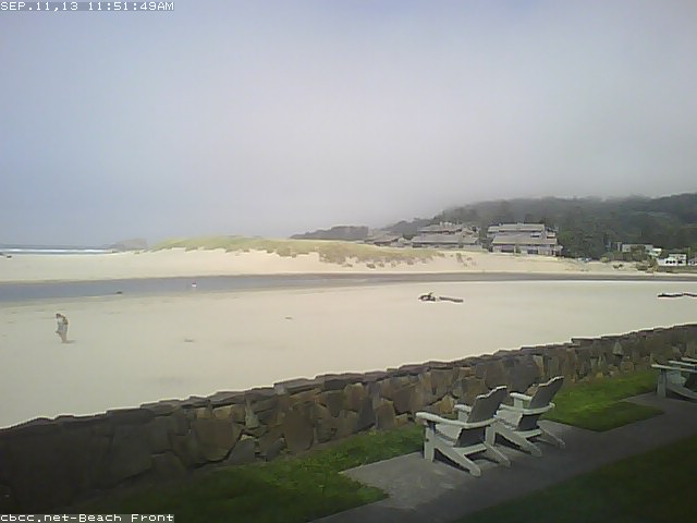
You can always play hooky and drive to the coast. Here is the situation at Cannon Beach, OR. It looks a little foggy right now (Noon) but will probably see a little clearing later on. Temps are almost always cool along the shore. This could be your last opportunity for somewhat warm weather along the Oregon Coast or SW Washington's Coast. As fall approaches the rain becomes relentless along those gorgeous cliffs. Autumn comes quickly.


Maybe the foggy coast is a little overkill on the beat the heat angle. 60's too chilly? OK Timberline Lodge could be the getaway for you! The NWS forecast for the historic Mt. Hood Lodge is 70s and sunshine.


Maybe a short drive up to Hood is just what the doctor ordered for heat expulsion. Keep in mind if you stay overnight it gets downright nippy after ten up at Timberline.


You know what do, get outside and take in the last blast of summer. If you don't fancy mid nineties then you will have to stay inside your cozy air-conditioned office until after 8pm. Of course, you could enjoy the coast or mountains one last time this summer. Either way, soak it up my friends, soak it up.


Monday, July 1, 2013

June is in the books.

June Daily Temps
Welcome to July and the beginning of our 75 days of summer, here in the 'Couv'. June began quite warm, was mostly mundane and a little drippy in the middle then finished like a new furnace. What a ride! The numbers tell of a warmer than average June with less than average rainfall, but honestly, it felt like it rained more than that. There were a number of localized squalls that poured down like a spring waterfall at times. The squalls just missed the gauge, I guess.

June Daily Precipitation
My rain bucket had a mere 1.69 inches for the month nearly an inch off the average for June. Temps were just a touch above normal both overnight and daytime.

July has started off just like June ended with high temps and a little more moisture than typical for hot days in Southwest Washington. Relative humidity has been running around 50% with temps in the high 80s to mid 90s. That puts the heat index up near 100 at times. Toasty warm for sure.

Wettest day officially at my station was 0.38 inches on the 19th. The warmest day was the last day at 92.6 and the first 90 plus day of the year. I measured 89.9 on the 28th. The highest heat index came on the 30th as well with 97 degrees. (NOAA calculation 92.6, 44% humidity). Coolest evening low was 44.4. Every day broke sixty degrees. We had twenty days of sunshine and nine days with rain.

My location tends to run a tad cooler than the official weather stations in the area. Several areas were reporting heat index values over 100 degrees. Personally I can do without high heat and our summers tend to have very few days over 90. Sit back and relax for Independence Day should be a mild eighty-five-ish. Soak it up.

Sunday, June 30, 2013

The Heat is On

The National Weather Service has had us under a heat advisory for the last few days and it has been toasty. Temps have been in the upper eighties and low nineties. Today, tomorrow and Tuesday are supposed to be the hottest of the the week. NWS is suggesting the temps will be in the mid-nineties with heat indexes at or above the century mark. The heat index is a measure of atmospheric conditions that effect the way we feel heat. We still have some residual moisture in the air which adds to a muggy feeling. Our low elevation adds extra "weight" as well so we will feel every bit of a 100 degrees if the mercury meets 95. If you go up to the mountains where the air is thinner you may feel less heat even if the temperature is the same. Remember just because you "feel" less hot does not mean it IS less hot. Humidity typically amplifies the effects of heat as well. We have been running at relative humidity in the 45%-60% range which gives the air a little "stickiness". Stay hydrated and minimize direct sun exposure.

Look at that forecast for Independence Day, mid eighties, that is sweet.


Stay cool these next few days and enjoy our late sunshine. Temps will remain quite warm and comfortable during our very long Northwest summer twilight and into the midnight hours. We screamed for summer, now it is here, soak it my friends, soak it up.