Showing posts with label stats. Show all posts

Monday, July 1, 2019

Hot and Cold June

Another month down, we now sit halfway through 2019. June played a pretty good June this time round. I had some clouds, some sun, some rain, some hail, a couple of scorchers and a few genuinely chilly moments. That's Miss Spring's classic Northwest exit.

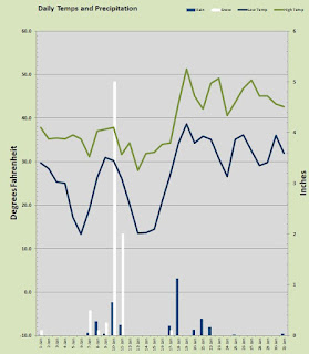
June was a tad on the warm side a couple of degrees up on light side and about normal for overnight. The hottest temp came on the 12th when the merc capped out at 98.8° one of two back to back 90 plus days both were daily records for me. The chilliest afternoon was also the only day that failed to reach 60° when it topped out at just 58.8° on the 27th. We had 9 days with overnight lows in the 40s, that's a fair bit for June and the coolest a 44.2° measured on the morning of the 9th and that was one of two mornings under 45° We did have one toasty overnight low when the merc stayed above 65° all night long. No surprise it cam after the 95.7° afternoon on the 11th and lead to the hottest day of the month on the 12th with that 98.8° I mentioned above.

The rain bucket was once again super dry. I typically see a couple of inches in the 'ole bucket in June this time just a paltry 0.89" We did have a pretty spectacular thunderstorm on the night of the 26th, power was out the whole nine-yards. That little monster dumped nearly half the months rain total in just a couple hours. Yet despite the theatrics, it was still only 0.41 in my gauge, so not enough. This is kind of serious, I am 16.75" off my typical rain figures through the first 6 months of 2019. That is only 11.70" of a 'normal' 28.45" and that's just 41% of normal. At this rate we are going to lose our reputation for deliriously damp and wonderfully wet.

All in all that was a nice June, just 4 days with any showers or rain and 21 days of mostly sunshine. July is looking like nice weather ahead and the 4th ought to be sunny and about average somewhere near 80°

It's time for the magical 75 days of summer in the Portland-Vancouver Metro Area :)

Tuesday, January 1, 2019

Happy New Year!

2018 is in the books and in a single weather word, it was... DRY. Not just dryer than average, bone dry semi-desert dry. But Rod, you live in Western Washington, how dry could it be? How about a paltry 25.32 inches of rain in the calendar year 2018. Yes precipitation years are measured like school years so we are only a couple of month's into the 2018-19 water year., but none-the-less 2018 was semi-arid and that total is barely better than half my 17 year average for precipitation.

While on the subject of precipitation, December ended up with a dry 4.25 inches of rain and just a spattering of snowfall that came in a light wintry mix on the 9th. That is barely over half my typical December rainfall number. The soggiest day delivered nearly an inch of rain, that came on the 18th with 0.95 inch. We had a total of 15 days with some rain and 7 days with sunshine. Nearly half of the wet days produced a quarter inch or more.

On the temperature front, the month was toasty warm compared to a "normal" December. Month 12 only produced 7 subfreezing lows and every day managed to get above the freezing mark. In fact, all but 2 days pushed the merc above 40 degrees. Despite the month being some 3 degrees warmer by day and night than average, there were no real warm days. The warmest temp I measured was a nice 56.5° on the 18th but that came with all that rain. The warmest overnight low was 45.5° also on the 18th. That was some pineapple express happening there. The coldest morning low arrived on the 6th with a 23.2°, nowhere near any kind of record but it was the chilliest December 6th since 2005. The coldest daytime high was closer to a typical high measuring 39.6° on the 9th.

Looking ahead to the rest of the winter, we are not looking good on snowfall, rainfall, and temps are running warmer by more than just a little bit. Things can change quickly and we have yet to have an outbreak of arctic air. I would expect at least one bout with a cold air mass dipping south into the Pacific Northwest and odds are some sticking snow will arrive during the next 6 weeks.

In the mean time, Happy New Year and hello 2019. Let's all continue to soak it up, my friends, soak it up.

Friday, December 1, 2017

Ho Ho Ho... another December is upon us

Another month is closed out and November, 2017 was damp and mild all month long. Some oddities about last month include nary a freezing temp all month long. In fact the average morning low was a balmy two over normal at 40.68°. Daytime highs were spot on average however right at 50°. The month yielded 19 days with rain and just 5 days with any real sunshine. That is a Northwest November. About six inches in the bucket which is fair but a bit drier than the normal 8 inches.

Temps were mild all month with no extremes at all. The warmest temp was a modest 59.7° on the 23rd and the chilliest morning a warmish 35.1° on the 18th. The coldest afternoon high was the nippy 40.6° recorded on the 6th and the toastiest overnight low came on the morn of the 29th when it only dipped to 49.6°. Exactly one half of the days managed to bust out over 50°.

The water works were wet but well below a typical November. 19 days and just six inches meant it was mostly showery. There were three of hydro-pumper days above 1/2 inch including the soggy 15th when nearly an inch came down (0.95 in). Not one snowflake fluttered in the breeze but several days saw snow levels dip down to the lower hills above 1500 feet.

If this first two months of autumn is any indicator of our winter, I'd say it will be rather mild this season. But alas, autumn is not a reliable indicator for winter. The magically merry day of Christmas is now just four and a half weeks out and one never knows what the potentially chilly month will bring. I will always vote for a white Christmas but the Northwest Weather  Gods rarely grant that wish. More than likely any snow will come after the New Year as my cumulative snowfall totals are heavy stacked in the first two weeks of January.

Happy Holidays and be sure to soak it up my friends; soak it up.

Tuesday, August 1, 2017

Hot August Nights?

July is in the books and it was for all intents and purposes: spot on average. With a average daily high of 81 and a average daily low of 55, I was one over by day and one under by night. Rainfall was a big fat zero and that is well below the historical "normal" of 1.02 inches. By no means however, is a bone dry July unusual.

July was just wonderful in every measurable way as far as weather is concerned.

As for the temps I recorded a monthly high of 90.1° that came yesterday and was the only temp in July above 90°. Every single day last month busted out over the top of seventy degrees and the chilliest afternoon was the 7th when 70.7 was the best she muster. So I had 19 delicious summer days between 80-90 degrees. I have said it before and I'll say it again, summers in the Metro Portland-Vancouver area are as good as any on this planet. I did have a three quasi-chilly morning lows where the mercury dipped into the upper 40s the coolest of which was a 48.9° recorded on the 11th of July. The warmest overnight low was a balmy 62.8° on the 23rd which was the only overnight low that remained above 60°.

There was no rain in the month of July so I have no stats for precipitation. July and August are typically the driest months of the year and it is not unusual to have a blank slate on precipitation during either month. It would be unusual to have both July and August bone dry in the same year. We shall see if that happens this year.

August is starting off with the furnace set to Venus levels. Today is expected to tease the century mark and both tomorrow and Thursday are forecast to bust well above 100°. Friday is another wild card that with tickle the triple digits. If all four days break one hundred degrees it will be a first for me in 16 years of observations at this station. Just to be clear, I have never recorded more than two 100° plus temps in a row. I have yet to record a dozen 100° marks in that 16 year period. We may get four this week! If I were betting on it, I'd say we get two of the four. We shall see it all begins later today. The NWS has already backed the high forecast for today at PDX down to 99° from the 100° they predicted in yesterday's forecast.

One interesting thing I see is the Wednesday evening low forecast at 71°. That is a 'Hot August Night'. My all time record for overnight lows was set back on July 22nd, 2006 when I recorded a low of 73°. That low came after a rare day of clouds and upper 90s and the cloud cover kept the heat in all night long. We are not expected to see so much as a whiff of cloud cover so I think that record is probably safe.

Get ready for the heatwave and go a head and soak it up my friends, at beach if need be, but soak it up.

Wednesday, February 1, 2017

Coldest January in Years!

We just closed out a chilly January here in the Metro Portland/Vancouver area. We had it all, bitter cold, snow, sleet, freezing rain, regular rain and even a little sunshine just for good measure. The local news in nearby Portland, OR has been reporting that last month was the coldest January on record sine 1979 and the coldest month since 1985. Of note, January 1979 was MUCH colder as sub zero temps were recorded here in the 'Couv' that year.

For those reading this blog from places like Wisconsin, Michigan, Minnesota, laugh it up because our "coldest" is about normal for you guys. For us it was a bona fide chilly month.

Starting with the temperatures, we were well below average. My 16 year average for January is 33.47 low and 44.62 high. Last month I observed an average low of 27.34 and average high of 39.34. That is a whopping 6 under on the low and 5 under on the high! Most of this was driven by a very cold first two weeks and then a typical last two weeks. Unlike 1979 which was driven by a massive arctic event with the aforementioned sub zero and single digit marks that may have skewed the whole month, this last month was not driven by epic cold but rather an extended cold. I have a several daily record lows based on my 16 years reporting. Here are my daily records for overnight lows, again I only have 16 years of data and most of these lows are not likely all-time daily lows. They are however recent daily lows and to have this many in one month is what is unusual not the actual temps themselves. None of these lows are any where near as cold as the lowest I have recorded in the last 16 years at this location.
  • Jan 5th 17.2
  • Jan 6th 13.3
  • Jan 7th 19.0
  • Jan 13th 13.5
  • Jan 14th 13.3
  • Jan 15th 14.5
  • Jan 16th 21.0
I also had a couple of daily highs that were the coldest on record for me at this location but none were anywhere near my all time record cold. Here they are:
  • Jan 6th 35.2
  • Jan 7th 31.1
  • Jan 8th 37.0
  • Jan 11th 31.6
  • Jan 13th 28.0
  • Jan 17th 34.3
Temperatures in the rural areas just outside of Vancouver, such as Brush Prairie, WA saw temperatures plunge into the low single digits. Long after the frozen ponds in the city thawed they remained frozen for weeks in the country. The all-time record low that I have recorded here dating back to 2002 is 8.7 degrees on the 9th of December 2009. The coldest daytime high I recorded here is January 6th 2004 when 20.2 was the warmest temp of the day. These lows fail miserably against the all time lows for Orchards, Washington which is the closet "official" station to me where -11 degrees is the mark to beat. Do to the heavy urbanization of this part of Vancouver since 1950 when that mark was recorded, it is likely to remain in perpetuity.

January 2017 had six days with lows under 20 degrees and 22 days below freezing. There were 5 days in which the mercury was unable to break above freezing and that is above the average for the whole season. The coldest low came on the 6th with 13.3, the warmest overnight low was 38.7 on the 19th. The warmest temp arrived on the same day as the warmest low when we had out lone 50 plus day at 51.3 degrees. The chilliest daytime high was the 13th when 28 under sunny skies was all she had. We can't underestimate the effect of a foot or so of snow on the ground had on the overnight lows. 

January 11th. 2017, Northeast Vancouver
Precipitation was light as far as water content rainfall is concerned but snow was well above average for the month. A typical January yields 7.05 inches of rain and last month garnered just 3.19. It was a very dry and cold air mass and that low water count was offset by 8.05 inches of frozen precipitation at my location. I average about 40 percent more snow than PDX but this last month the snow was heavier along the I-5 corridor than it was at my location. Downtown Vancouver had over a foot on the ground last month. The bulk of my snowfall came over two days when 5 inches and 2 inches hit on the 10th and 11th of the month. The 8 plus inches I recorded is the second most in January since I started measuring in 2002. It does pale against the more than 16 inches that came in January of 2004. It is the 4th snowiest month since 2002 for me and it was well above the 3.3 inches I average in January. This season so far is the 4th snowiest winter I have dating to the 2001-2002 season. I am sitting at 13.85 inches thus far and I still have two potentially snowy months ahead. February and March average for me 1.28 and 0.91 respectively so it is possible that we could knock the number three season out since we just need a 1/4 inch to do it. I have not had ANY snowfall in February since 2014 when I had over 11 inches. I haven't had any sticking snow in March since 2012 when I had a crazy 7.85 inches. My gut says I'll get another 1/2 inch at least before the end of the season so there is a solid chance that this will go down as the 3rd snowiest winter since I started recording data in 2002.

January 12th, Downtown Vancouver
Overall this winter has been the rather chilly by our standards. We are blessed to have a very mild winter despite our northerly latitude of 45.6 degrees. Mind you that is substantially further north than much colder places like Minneapolis, Boston, and even Portland ME. Our close proximity to the Pacific Ocean and the protection of both the Cascades and Rockies from the wicked continental cold keeps us relatively warm. Our winters are rather short all things considered with about six weeks in the fro-zone. 

Here we are in February and the average temps will typically rise steeply. From Mid December to Mid January we are delighted if we get a day that tickles the 50 mark, but in February our average daily high is already approaching 50 degrees. we may not be finished with frozen precipitation but we are headed rapidly towards spring.

Later this week we may see some more snow and ice but it will likely be minor and only serve as a gentle reminder that winter does extend into March; officially at least.

Soak it up my friends, soak it up.

Friday, May 1, 2015

April Showers Were Light

The showery month of April is in the books and I had about half my typical April rainfall. I was delighted to post the first 80 degree mark of the season however so that was nice. April was all over the place with several warm days and a few chilly nights but no extremes really at all.

We managed to get all the way through the month of April with out ever dipping below the freezing mark. We got close a few times but I managed to stay above the whole way through. all but one day managed to get above 50 degrees as well.

The warmest day of the month was the 27th with a toasty 81.6 degrees as I said before, the first 80 plus mark of the season. The coldest temperature was recorded the morning of the 15th with a 33.2 mark on tax day! The warmest overnight low came on the same day as the warmest high with a low of 49.4 on the 27th. The coldest afternoon high arrived on the 14th with an almost 50 mark of 49.8 degrees. We enjoyed 8 sunny days, 12 with rain.

Speaking of rain. I only managed to record 2.15 inches for the whole of April and my typical mark is 4.24 inches. Only half as much as "normal". The wettest day was the 14th with 0.41 inches. We had several days with angry thunderstorms that dumped torrents of rain in isolated areas. Some areas nearby likely recorded an inch or so more than I did if they got hit with those cloudbursts.

The merry month of May is under way and I think we will see more and more of that big yellow orb so be sure to get outside and soak it up my friends, soak it up.

Monday, December 1, 2014

The Final Month of 2014 Commences!

Wow, 2014 is just about gone. Crazy fast it went this year. Looking ahead I don't know what to think about the weather. We have had warm and cold in the last 30 days. There does not seem to be the proverbial weather harbinger this time around. We'll just have to wait and see.

November was about as spot on average as possible for temperatures. My 13 season average November low is 38.28 and my observed average low last month was 38.23. The 13 year average high is 50.31 and my observed average was 50.67. Like I said, spot on! precipitation was another tale altogether. My 13 season average is 7.98 inches and this year was a scant 3.08. Of the 5 "snow" months November has been the least likely to receive the fluffy white stuff. This time we got 1.1 inches of snow against the 13 season average of 0.49.

So the coldest temp was the 16th with a mark of 20.1. The warmest temperature was a balmy 61.3 on the 26th. The chilliest afternoon high came on the 13th with 36.8 and no surprise that was the day we got most of the month's snow. The warmest overnight low came on the 26th with a toasty July like 54.5 degrees.

We had but 2 days with rainfall exceeding 1/2 an inch. The wettest day a paltry 0.62 on the 21st. I recorded 8 subfreezing low temps.

What will this December bring? Will there be a white Christmas? Odds favor a no on that. Will it be wet? Cold, Warm? Who knows? Not me. It will be a great December and I wish you all a happy holiday season. Now get out and soak it up my friends; soak it up.


Wednesday, October 1, 2014

So long September, Now the real Autumn begins

October is here and the real autumn will step up and be noticed. September turned out to be a pretty warm month. I had average temps well above my 13 year normal. Overnight lows averaged nearly 54 degrees 2.5 above normal. Highs hovered just north of 77 degrees averaged over the month, that's 3 degrees above the established norm. The hottest day was the 6th when I measured 96.4 degrees and that was the third hottest day of the year. Speaking of hot, this past September recorded an impressive four days above 90 degrees. All told this year has delivered 11 days above the 90 mark. The coldest temp last month was a mild, 45.3 on the 4th. The coolest afternoon high came on the 29th when the merc topped out at 61.7. The warmest overnight low arrived on the 22nd with 61.1.

The month seemed to be rainy but really was about half of normal with my bucket collecting a mere 1.29 inches against my baker's dozen of years averaging 2.47. I had 9 days with something dripping in the rain gauge but only 6 days mustered more than trace. The wettest day was the 23rd with 0.61 inches.

October is a month that sees the Autumn plunge in full swing. Temperatures will plummet from an average high of 70 on the 1st to and average high of 52 on Halloween. The leaves are starting to flash a little color and the sun sinks fast in the west. Get ready to enjoy the brightest display of flora in the next few weeks.

Soak it up my friends, soak it up.

Wednesday, April 2, 2014

March is Gone, Hello April

The Merry Month of March is in the books and the only real madness we had was the kind we like... in the NCAA Basketball Tournament. This March can be summed up in a word; "wet".

The rain bucket soaked up seven and a half inches of wild and wet precipitation. There were thunderstorms and some hail but nary a flake of snow down here in the city. The wettest day was the 5th with a whooping 1.14 inches coming down. There were 12 days with more than a quarter inch of rain and 20 days with measurable precipitation.

Temps for last month were pretty typical for March. Average lows at 39.13 which is a touch warm and daily highs averaging 56.06 two degree above average. The chilliest low was a nippy 29.1 on March 22nd and the warmest mark a sunshiny 71.4 which occurred on the 24th. That was the first 70 mark since October 22nd, and it felt GREAT. The first day of March managed a high of only 42.6 and that was the chilliest high temp of the month. On the 9th the mercury stayed above 50 with a low temp of 50.5 that was the warmest low of the month. The entire month only yielded 4 days with a subfreezing mark and 8 days with the high temperature reaching at least 60 degrees.

Other than the soggy otter effect of 7.47 inches of rain, March was pretty nice. April is allot like March just a tad warmer as we move away from the clutches of winter and into the fickle spring.

Soak it up my friends, soak it up.  

Saturday, February 1, 2014

A Big Bowl of Burr, is Headed our Way

January is done and temperatures were par for the course. It all averaged out to pretty close to normal. The average daily low was 33.88 just a tick above normal and the average daily high was 45.89 a little more than a degree on the warm side. The coldest temp was a chilly 22.8 on the 5th and the warmest was a balmy  55.2 on the 24th. We managed to get above freezing every day with the chilliest afternoon a foggy 37 on the 4th and the warmest overnight low came on the 10th with a toasty 46.2.

Once again rainfall was the topic of trouble. It was a well below average 3.78 inches in the bucket. We had 15 days with subfreezing lows and a whooping 8 days with the mercury buzzing around in the 50s. Only 10 days were rainy and 11 days were sunny. More sun than rain in January? Yep. You don't see that very often.

Nary a flake of snow was seen in the month on January down here in the city. Overall it was a ho hum winter month that never really got too cold and frankly it was nice more often than not. I have no complaints about that!

Things are going to change back to more wintry condition this week however. More of that wonderful arctic air is set to drop in over us. There will be some cold and dry days and possibly some cold and white, fluffy days. Tough call on snow this late. The mighty fireball manages to get up a little higher in the sky as we move closer to spring. That means it can do a better job of warming the air. So I doubt it will be single digit cold like it was in December but teens here at my station are not out of the question. It looks like a big bowl of burr, is headed our way.

Since I have been keeping records at this location I have not had much snow in February. In fact, I average quite a bit more in March. But the law of averages says February is due, so I say bring it on.

Wednesday, January 1, 2014

Happy New Year!

Hello and like the title says, Happy New Year! The New Year's Eve was foggy and about average for temps across our region. I hope you all had a great time.

Another month is in the books and December went down as rather chilly and bone dry for December. A lack of precipitation has been the theme in calender year 2013. Just 31 inches of rain fell from January 1, 2013 till New Years Eve. We were well below average on both daily highs and overnight lows. I had one morning with a low just 1/2 degree shy of my all time (12 years) low.

Let's take a look at the month by the numbers. The average observed low was 30.14 degrees which is nearly 3 cooler than my 12 year average for December. Also roughly 3 under was the average highs at 39.20 degrees. The coldest morning was a 9.1 on the 8th and the coldest afternoon high was on that same day with a reading of 26.9. The warmest temp was on the 1st of the month with a balmy 53.7 degrees and the warmest overnight low came on that same day as well with 46.2. The wettest day was the warmest day bringing 1.8 inches of rain on the first of the month. That was more than half the monthly total which amounted to a desert-like 3.2 inches. I typically have about 8 in the bucket in December. We had some light snowfall totaling just 1.75 inches, most of which fell on the 6th.

Precipitation Rain and Snow
This month had the longest stretch of continuously sub-freezing temps since I began keeping records here in 2002. I have had several three day stretches under the freezing mark but this one went a full five. It is not rare for the daytime highs to be stuck under 32 but it is unusual. Stringing a whole work-week of sub freezing days is legitimately rare.

The initial look for the first half of January is pretty standard fare for winter with average temps and typical precipitation. The whit fluffy variety appears to be staying up above 1000 feet for the next several days. But as usual, you never know.

Get out and enjoy the weather. Soak it up my friends, Soak it up.

Tuesday, December 3, 2013

The Sun is Shining Big and Bold but it's Still Cold

December is starting off with another blast of cold, arctic air. This one is supposed to be a bigger and colder event than last month's episode. So far however, it has been a mild cold. Some of you may have seen some flurries yesterday, there was nothing white and fluffy here at my station, however.

Virtually every weather website and service is indicating that a very cold air mass will entrench itself in the area over the next several days. The forecasts for the rest of this week are clear and cold. Most are suggesting a week of snow possibly coming as early as this Thursday. Predicting snow is a dicey proposition west of the Cascades. We have so many geological, topographical and atmospheric variables. The biggest influence is the largest body of water on Earth. The mighty Pacific Ocean sits just 90 miles away and in the winter it acts as a natural heater. Of course it is a weak heater with water temps hovering in the 40s. It still acts as a temperature moderator when cold air is in place. Most of our weather systems come in from the west off the coast and brings with it that oceanic moderation of temperature. Generally it takes either a cold east wind through the gorge or a truly frigid arctic air mass to set us up for anything more than dusting of snow.

National Weather Service Forecast as of this morning


Well, apparently several computer models are suggesting that a snow producing weather Trifecta is building up for next week. Here is a little checklist: High pressure building in the East and set to produce those frigid East winds through the gorge; Check. A cold arctic air mass moving in from the north; Check. A moisture laden storm out in the Pacific heading our way; Check. And as a measure of confidence it has been almost precisely five years since the last major snow event. it seems that the stars are aligned and all the required elements for a significant snow event are brewing. It all comes down to timing and whether or not the good Lord is just yanking our chain... again. So shall we see. I am very confident we will see snow from this event but it may not be the proverbial "Big One" some weather sites are suggesting. Since I seemed to have misplaced my T.A.R.D.I.S., we will just have to wait it out, if you'll pardon the 'Doctor Who' parlance.

So much for the future, the past is so much easier to predict, isn't it? November is in the books and in a word, it was; 'dry'. Just 3.11 inches of that precious water fell from the skies in a month that should see nearly eight at my station. So yes, it was dry. It would have been a warm November as well had it not been for that blast of chilly air that arrived late in the month. It was a beautiful month with nine gorgeous sun filled days.

The stats rolled out like this:

We had 16 days with precipitation of which 6 exceeded a quarter inch and totaling 3.11 inches for the month. The most was .55 inches which occurred on the opening day of the month. It was the precursor for a wet month that never materialized. Nary a snowflake all month but that is not unusual for November. The chart on the right makes it look wetter than it was. Seven of those "rainy" days had less than a tenth of an inch. And then there were those nine glorious days of brilliant sunshine provided by our home star.


Temperatures were slightly chillier on average for the month with my observed daily average low at 36.80 and observed daily average high at 50.09 degrees against my twelve year averages of 38.47 and 50.30. I had 10 days with a low temperature below the freezing mark and not a single time did the mercury push past the 60 degree mark. The warmest temperature was 58.8 on the 11th and the coldest was a tie on back to back days starting on the 21st with a pair of 20.4 degree readings. The warmest overnight low came on the evening of the 7th with a 47.4 degrees. The coldest afternoon high temperature was mild 42 degrees on the 29th.

So we have a few days on tap with the great yellow orb blazing away in the big blue sky before the snow event occurs. So get out there and work on your tan, then get out there and play in the snow, be a little or allot. Go on my friends... Soak it up.


Wednesday, October 2, 2013

A Slippery September has Slid into the Books

Daily Rainfall for September
How's that title for a tongue twister? September was quite wet in fact it was the wettest month of 2013, thus far. I recorded more than five inches of rain in a month I typically see less than two and half. That says as much about our dry winter and spring as it does for a damp late summer.

The temperatures were a touch chilly by day and a tad warm by night compared to my long term averages. That said I also recorded the hottest day of 2013, a blistering 94.6 on the 11th. I think that will stick at this point lest we break the all time heat record for October by 5 or 6 degrees. The lowest afternoon high was a cool 53.7 on the 27th. September's evenings were comfy as we enjoyed mild temps most of the month with an average overnight low of just under 55 degrees, the warmest was 62.4 on the 2nd and the chilliest came in at 43.8 on the 19th. The wettest day of this watery month came on the 28th when 1.55 inches fell. That was the second day this past month with over an inch of rain. Although the rain gauge had 5.23 inches for the month, there were only 11 rainy days compared to 13 sunny days.

Daily Temperatures for September

The Autumn Plunge I have talked about this past month is well under way. By Halloween our highs will struggle to get into the mid 50s. It is time to break out the sweaters if you don't like it chilly. For me it is not quite sweater weather yet. I will be watching for our first frost and freeze of the year. I find that both typically arrive in October with a frost in the first ten days and a hard freeze by week three.

I am noticing that some of the early turners have begun to flash some color. Of course, I am talking about autumn leaves. Here in the Northwest we are granted a gift of brilliant and beautiful color as recompense for a precipitous drop in temperature.

Looking ahead to winter, the almanacs are suggesting a cold and snowy season awaits on the other side of Thanksgiving. Those ancient periodicals The Farmer's Almanac and The Old Farmer's Almanac, that have been continuously published since 1818 and 1792 respectfully, are both pointing to reduced solar activity and oceanic conditions in their predictions of a frigid winter. Hmm, we are due for a snowy winter. Last time I had more than ten inches of snow was 2008-09 and that was five years ago. Almanac, schmalmanac, I have my own anecdotal evidence and I think were in for white winter this year. So get outside and soak it up my friends, soak it up.